The Road Trip
On a drive to North Carolina, Dean kept asking, “Are we there yet?” He wasn’t being impatient. He knew where we were going; he just had no way to picture the progress.
I had GPS, a moving dot, miles, and an understanding of time. He had none of those. But he did understand landmarks.
So I designed a printable trip strip that translated the drive into his language:
Home → playground → lunch → Peachoid → rest area → cousins
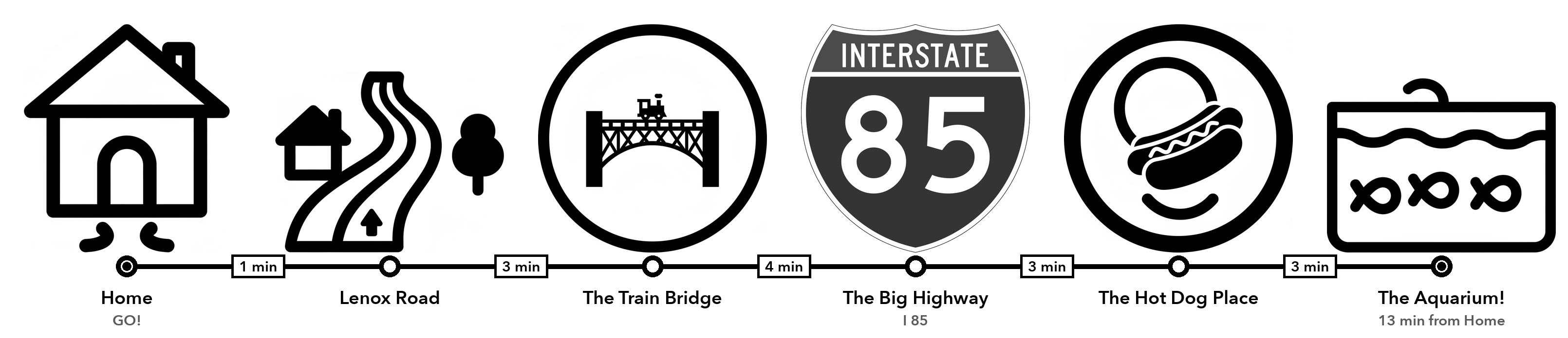
Instead of asking a 4-year-old to track 47 miles or 42 minutes, the strip gives him a sequence of recognizable events. Each trip has today’s destination, landmarks, and stops.
The Larger Idea
ToddlerMaps is the umbrella, not a single product. It shares maps, image generation, schedules, and thermal printing across several related experiments:
- Trip Maps — road trips and familiar drives told through landmarks
- Visual Schedules — everyday sequences a child can see and anticipate
- Printable Maps — real local roads simplified for tracing and coloring
- Sticker Studio — custom colorable labels generated from a spoken idea
- Print Lab — the shared printing workflow behind the other experiences
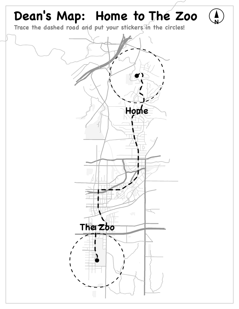
This page spotlights Trip Maps. The other experiences deserve their own stories as they develop.
Building an Internal Map
The idea expanded beyond long drives. I narrate ordinary routes in terms Dean can hold onto: “We’re turning onto Lenox Road,” “This is the curvy road,” and “That’s where the school buses sleep.”
It helps him construct an internal map of his world.
There are early signs that may be happening. On one drive, he noticed, “This isn’t the way to our house.” On another, he predicted, “Next is Morningside Place.” Those are early observations rather than measured outcomes. They tell me more than the number of maps the system generated.
What I Learned
- The trigger was a child’s missing mental model—not AI, maps, or the printer
- Adults think in time, distance, GPS, and addresses; young children think in landmarks and events
- Thermal printing eats detail, so simple pictograms and real road signs work better than intricate illustrations
- The most important stop may not be the destination. A familiar lunch spot can mean more than the aquarium at the end
Where the Printer Fits
The hardware entered the story late, and that ordering matters. Seeing StickerBox — a roughly $100 kids’ AI sticker printer — triggered the realization that equivalent mono thermal hardware was already sitting on our kitchen counter: the Brother label printer I’d tried and failed to connect months earlier.
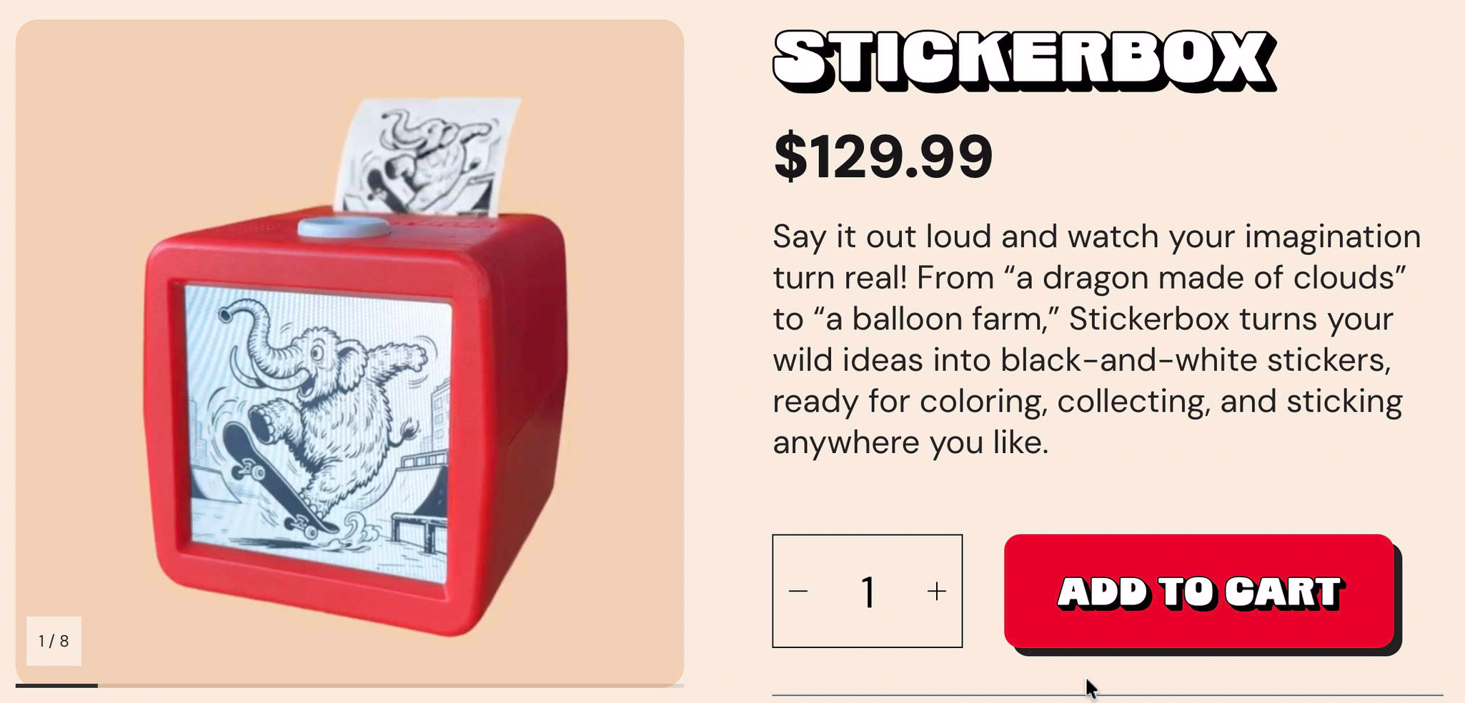
Connecting it gave us instant wireless physical output for one specific child and one specific trip. But the printer is infrastructure; the product insight is translating between adult and child mental models.
What Still Needs Testing
I haven’t formally measured whether the maps improve spatial reasoning or reduce “Are we there yet?” questions. I still need to document how many trip strips have actually been printed and used in the car, how Dean interacted with them during a drive, and which landmarks are most useful. For now, the evidence is observed route recognition and prediction—not a causal claim.